Drawing Parralels Between The U.S.A. and The Middle East
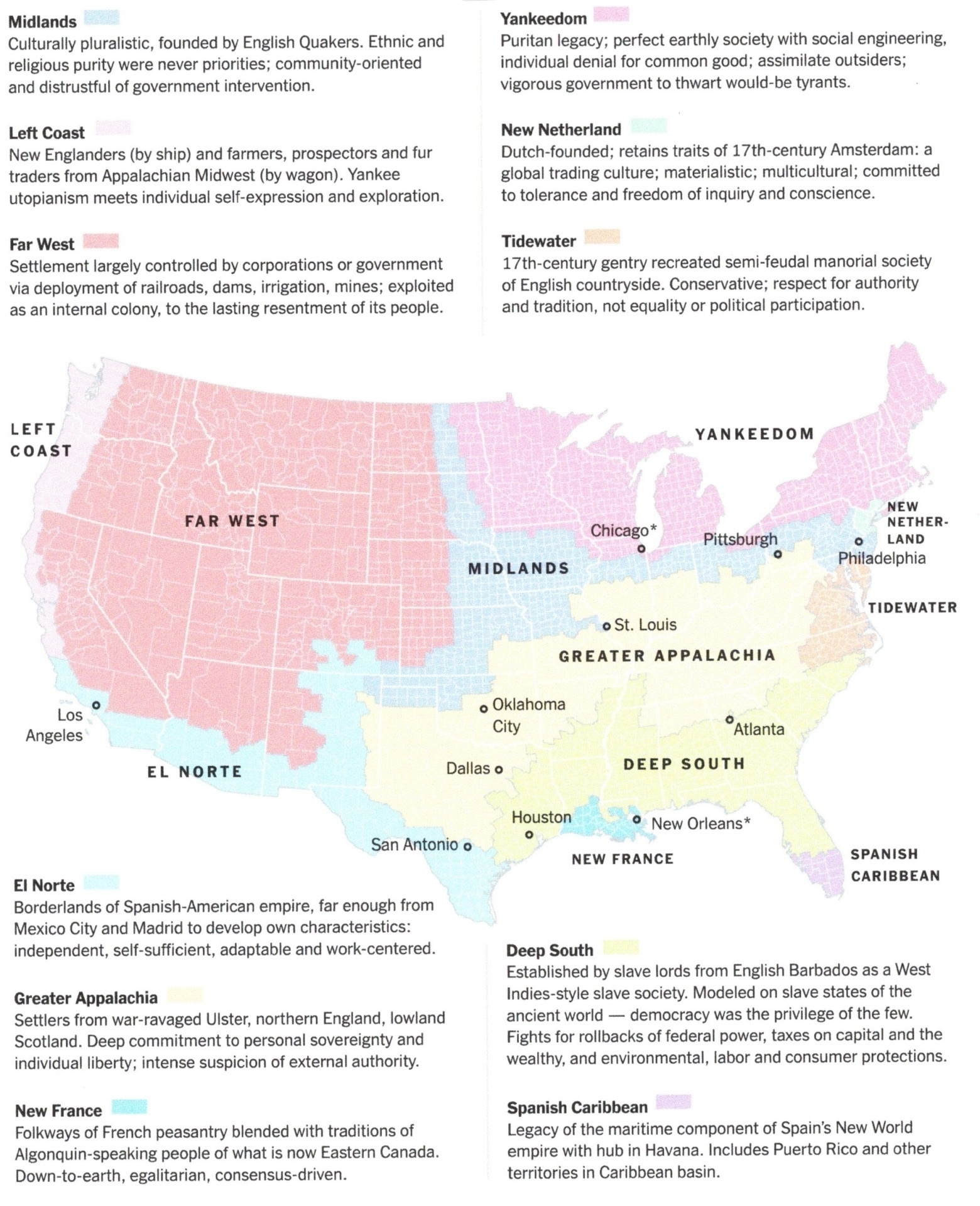
Maps that Show the Historical Roots of Current US Political Faultlines.
Interesting piece even of itself. But even more so if you read it and draw parallels with other parts of the world.
My interpretation is that the boundaries on this map are ‘cultural boundaries’, reflecting what people feel and how they relate to each other in the U.S.A.
 Now imagine if instead of mapping the U.S.A., you mapped The Middle East.
and
Rather than using state lines, you used the borders of countries.
In all honesty, I have seen maps like this in the past. Things like how the Kurdish culture spreads across at least 4 contiguous countries.
One difference between the States and the Middle East is that moving between states in the U.S.A. is a whole lot simpler than between countries in the Middle East.
I think this starts to expose the Middle East ‘fault lines’ in a very clear and explainable way. That is the historical imposition of political boundaries over people might make short-term sense and ‘bring order to the world’ - in the long term, it is ‘cultural power’ that drives the different regions of the world - and will be the final driver/decider.
This ‘culture trumps politics’ model is something that Venkatesh Rao touches on in this article from 2011. It is a long but fascinating read.